The Kalyan-Shilphata corridor is being rebuilt around four things: the Airoli-Katai Naka freeway link to Navi Mumbai, Metro Line 12 from Kalyan to Taloja, the existing central line at Dombivli, Thakurli and Kalyan, and the Thane high-speed rail station. Most of the value is in the first two, most of the risk is that both are under construction, and the single most useful habit when comparing projects on this corridor is to compare MahaRERA numbers rather than locality labels.
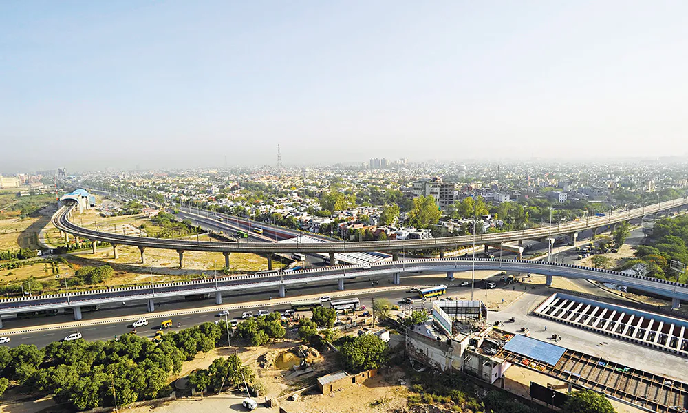
Kalyan-Shilphata Road, which almost everyone shortens to Kalyan-Shil Road, is one of those arterials that explains a housing market better than any price chart. It runs across the eastern edge of the Mumbai Metropolitan Region, links the Kalyan and Dombivli belt to the Navi Mumbai employment corridor, and for years it was better known for how long it took than for where it went.
That is the part that is changing. This guide walks through what is being built on and around this corridor, what each piece actually does for a household, and which claims about it you should treat carefully.
Start with the honest version of the problem
Historically, the eastern MMR had cheap land, decent rail access into Mumbai and terrible road access to Navi Mumbai. If you worked in Airoli, Ghansoli or anywhere on the Thane-Belapur industrial spine and lived in Dombivli or Kalyan, your commute was a compromise you renegotiated every morning. The suburb was affordable because of that friction, not in spite of it.
Everything on the list below is, in one way or another, an attempt to remove that friction. That is why the corridor matters and why it is worth understanding as a system rather than as a list of names.
1. The Airoli-Katai Naka freeway link
This is the single most consequential item for anyone commuting east to west across the region. The freeway connection towards Airoli is designed to give the Kalyan-Shilphata belt a fast route into Navi Mumbai that does not depend on the old surface crawl along Shil Road.
What it changes, practically: it turns a Navi Mumbai job from a reason not to live in Dombivli East into something a household can actually plan around. Rustomjee's own connectivity sheet for its Dombivli East project puts this link at about 2 km from the site, which is close enough to be a daily fact rather than a brochure line.
What to be careful about: freeway links get judged on their worst hour, not their best. Ask anyone who already lives on this stretch what the evening peak looks like before you assume a distance figure equals a travel time.
2. Mumbai Metro Line 12, Kalyan to Taloja
Line 12 is the metro corridor planned through the Kalyan-Dombivli belt towards Taloja. On the developer connectivity sheet for the same Dombivli East address, the nearest stations are given as Golavli at about 2.7 km and MIDC at about 3 km.
What it changes: metro changes last-mile economics permanently once it opens. It decouples a suburb from its single railway station, it makes the areas two and three kilometres off the station line genuinely viable, and it tends to be the infrastructure that shows up in resale values rather than just in launch marketing.
What to be careful about: do not buy a metro opening date. Metro timelines in the MMR move, sometimes by years. Treat a line under construction as a medium-term improvement to the area's fundamentals, not as a dated event you can plan a resale around. Any website that gives you a confident opening year for an under-construction metro line is telling you something it does not know.
3. The central line: Dombivli, Thakurli and Kalyan junction
The suburban railway remains the backbone. For an address off Kalyan-Shil Road, the developer's sheet puts Dombivli and Thakurli at about 5.6 km each and Kalyan junction at about 5.9 km.
What it changes: nothing new, and that is the point. The central line is the reason this belt was ever residential. What is worth noticing is the distance itself. Roughly 5 to 6 km from a station is far enough that you are not living inside the railway's noise and congestion, and close enough that the line is a real option rather than a theoretical one. It also means the metro line above matters more here than it would for a property sitting on top of a station.
4. The Thane high-speed rail station
The Mumbai to Ahmedabad high-speed rail project includes a station at Thane. The same developer sheet puts it at about 9.6 km from this part of Dombivli East.
What it changes: very little for a daily commuter, and a lot for the way the wider Thane district gets positioned over the next decade. A high-speed rail station is an intercity asset, not a suburban one. Treat it as a long-horizon factor in the area's profile rather than as something that will affect your Tuesday.
5. Retail and the everyday layer
Infrastructure gets the headlines, but the thing that decides whether a suburb feels liveable is the everyday layer: groceries, schools, a hospital within a sane drive, somewhere to take the family on a Sunday. The developer sheet puts Viviana Mall at about 3 km. A D-Mart is reported at about 2.5 km and Xperia Mall at about 2.9 km. Both are compiled figures rather than surveyed ones, so re-measure them yourself.
Why the same address gets two different locality names
If you are researching this corridor you will notice the same project listed under Dombivli East in one place and Kalyan East in another. It is one project. The parcels along this stretch sit close to the Dombivli and Kalyan municipal boundary, and that boundary gets resolved differently in different listings.
The practical lesson: when you compare listings on this corridor, compare MahaRERA registration numbers, not locality labels. A registration number is unique. A locality label is an editorial decision made by whoever built the listing.
How to read a connectivity claim on any project website
- Ask who published the distance. A developer's own sheet and an aggregator's compiled data are two different levels of reliability, and a figure with no source behind it is a third. Ask which one you are reading.
- Distinguish distance from time. Kilometres are a fact. Minutes are a claim about traffic on an unspecified day.
- Separate what exists from what is funded from what is announced. An operational road, a line under construction and a proposal in a plan document are not the same asset, even when a brochure lists them in the same column.
- Discount anything with a confident future date. Especially metro and tunnel opening years.
- Go at the wrong time. Do the site visit in the evening peak, not at eleven on a Sunday morning.
What this corridor is, in one paragraph
The Kalyan-Shilphata belt is where a large share of Thane district's road and metro investment is landing, and where the gap between "affordable but disconnected" and "affordable and connected" is actually being closed. That is a real thesis and it is why developers who previously ignored this micro-market are now building in it. It is also a thesis with a delivery risk attached, because most of the value depends on infrastructure that is under construction rather than open. Buy the location on what exists today, and treat what is coming as upside rather than as the reason for the purchase.
If you are looking at a specific project on this corridor, the same discipline applies to the project itself: check the registration, check the registered completion date, and check them per tower rather than per brochure. For Rustomjee Urban Woods, all six registrations are laid out on our tower-wise MahaRERA page, and what a registered completion date legally means is explained on the possession page.